mail_outline sales@mediastorehouse.com
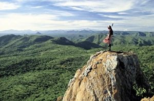
A magnificent view from the eastern scarp of Africa sA magnificent view from the eastern scarp of Africas Great Rift Valley at Losiolo, north of Maralal. From 8, 000 feet the land tumbles away 3, 000 feet into rugged valleys and a broad plain
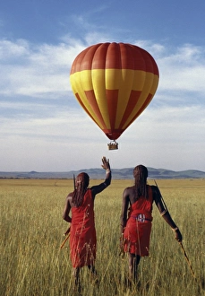
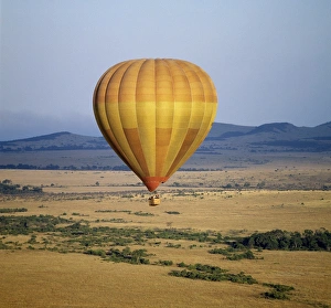
Two Msai warriors watch a hot air balloon flight over Masai Mara
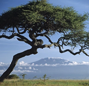
Framed by an Acacia tortilis, Mount Kilimanjaro is Africas highest snow-capped mountain at 19, 340 feet above sea level
On a clear morning, a Samburu warrior looks out over miles of unspoilt semi-arid country to Mount Kenya, 70 miles distant as the crow flies
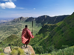
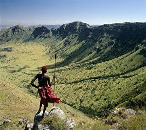
A Samburu warrior looks out across the eastern scarp of Africas Great Rift Valley at Poro, Northern Kenya where the land drop precipitously 3, 000 feet
At 509 feet below sea level, Lake Assal is the lowest place in Africa. From time immemorial, nomadic Afar tribesmen have come here regularly with their camels to collect salt
The scene at a Msai manyatta south of Lake NatronThe scene at a Msai manyatta, or homestead, as the first rays of sun herald another scorching day in an arid part of northern Tanzania, south of Lake Natron
Lake Natron in northern Tanzania is one of the most alkaline of the Rift system. As its waters evaporate in the intense heat, sodium sesquicarbonate, known as trona or natron
Wildebeest stampede plains of the Ngorongoro HighlandsWildebeest stampede on the dry grassy plains on the west side of the Ngorongoro Highlands
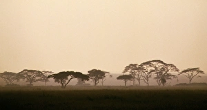
acacia trees in Tanzanias vast Serengeti National ParkAn early morning mist silhouettes acacia trees along a seasonal watercourse in Tanzanias vast Serengeti National Park. The mist will soon evaporate beneath the rays of the rising sun to herald a
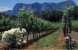
Thelema Mountain Vineyards near Stellenbosch
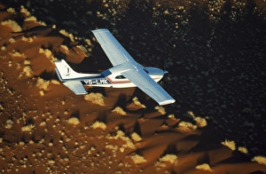
Safari flights over red sand dunes of Sossusvlei, Namib-Naukluft National Park, Namibia
The last rays of the setting sun over the Okavango River at Rundu
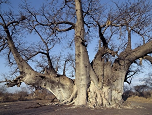
The Grootboom baobab tree in Bushman country near Tsumkwe. This ancient tree has a circumference of over 30 metres and will be more than one thousand years old
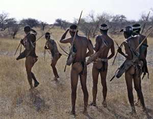
!Kung hunter-gatherers pause to check a distant wild animal in the early morning. The !Kung are a part of the San of Southern Africa who are often referred to as Bushmen
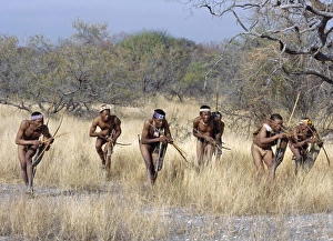
A band of !Kung hunter-gatherers makes a stealthy approach towards an antelope, their bows & arrows at the ready. The !Kung are a part of the San of Southern Africa who are often referred to as
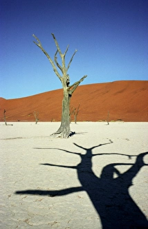
Dead Vlei
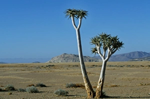
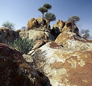
Quiver tree (Aloe dictitoma) and Bloodkopje northern section of park
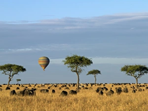
A hot air balloon floating over herds of wildebeest and zebra in the Masai Mara Game Reserve
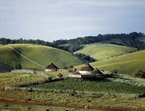
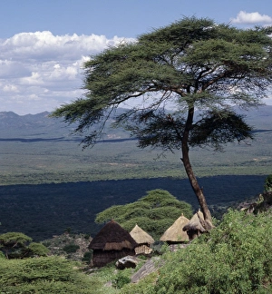
Traditional African houses surrounded by good pasture on the top of the Cherangani Hills. The raised platform is used by the farmer as a sheep pen at night
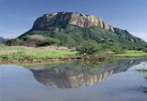
Mount Lololokwi, or Ol doinyo Sabachi, is a prominent flat-topped mountain situated near the Samburu National Reserve in Northern Kenya
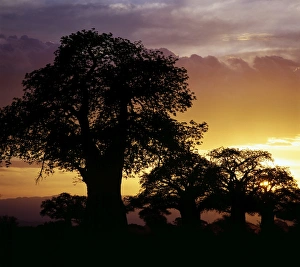
Giant baobab trees silhouetted against a sunset
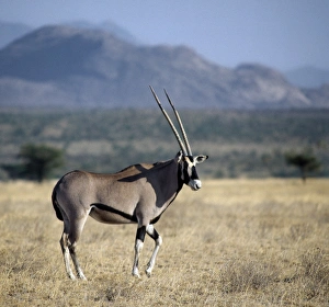
An oryx beisa in arid thorn scrub country, which is typical of northern Kenya. The distinctive markings and long straight horns of these fine antelopes set them apart from other animals of
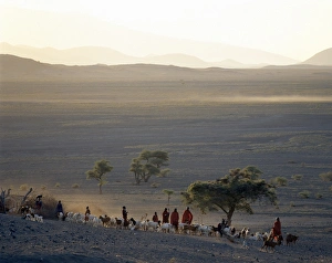
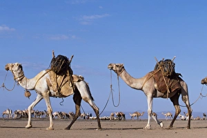
Camels belonging to the Gabbra are loaded with water carriers and attached together in a camel train approach at a water hole on the edge of the Chalbi Desert
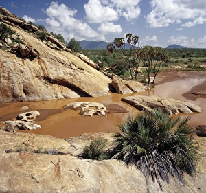
The Uaso Nyiru River ( a name adapted from the Msai name for it, Ewaso ng iro, meaning the red water river) flows through a spectacular gorge in Shaba National Reserve of Northern Kenya
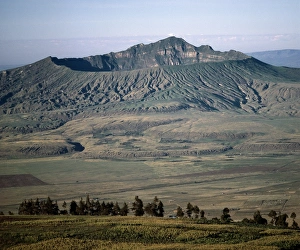
Mount Longonot, 9, 110 feet high, lies on the floor of the Great Rift Valley, thirty-five miles northwest of Nairobi. It is called after the apt Msai name for it: Ol doinyo Loonongot
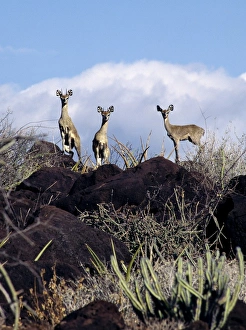
A rare sight of three klipspringers (Oreotragus oreotragus), a small antelope that lives in rocky terrain. It stands on tips of truncated hooves
Traditional Marakwet houses built on the rocky eastern slopes of the Cherangani Hills have a fine view across the Kerio Valley
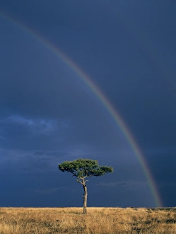
As the late afternoon sun bathes a lone Balanites tree and the red oat grass of the Mara plains in golden light, distant storm clouds and a double rainbow fill the sky
An early morning hot air balloon flight over Masai Mara
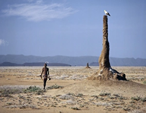
A Turkana man strides purposefully across the treeless Lotagipi Plains as an Egyptian vulture (Neophron percnopterus) watches him atop a termite mound
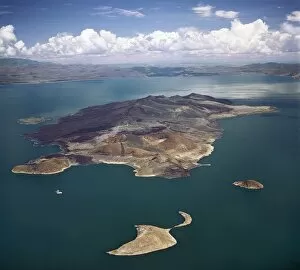
An aerial view of South Island, Lake Turkanas largest island. Situated in the southern sector of the lake where the water reaches a depth of 374 feet
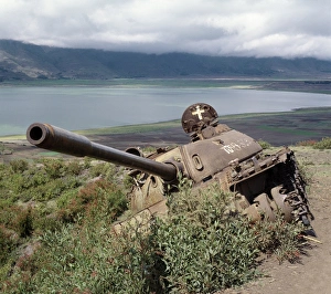
The defeated forces of the former Ethiopian dictator, Mengistu Haile Mariam, left behind this wrecked Russian-made tank near Lake Ashange in northern Ethiopia.; Africas regional
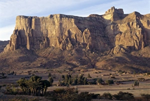
In the golden light of early morning, the spectacular Gheralta Mountains of Northern Ethiopia dwarf Tigray homesteads built on the Hawzien Plain hundreds of feet below
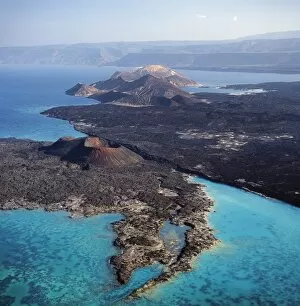
An aerial view of the volcanic cones at the inlet of Ghoubbet el Khar‰ b (the Devils Throat), a region of high seismic activity where deep fractures in the lava continue to widen year by year
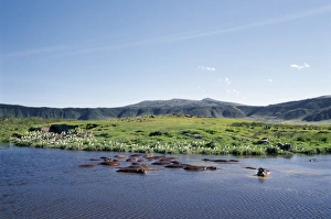
Hippos wallow in a lake in the Ngorongoro CraterHippos wallow in a small freshwater lake on the floor of the world famous Ngorongoro Crater. The craters 102-square-mile floor is spectacular for wildlife
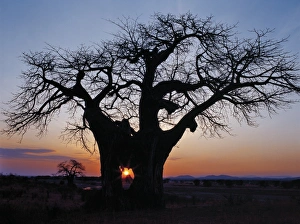
Sunrise through the hole in a baobab treeSunrise through the hole made in a baobab tree by an elephant in the Ruaha National Park of Southern Tanzania. In dry weather, elephants eat the bark and fibrous pith of these trees
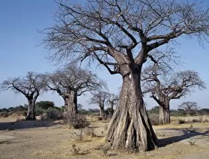
Baobab trees in the Ruaha Valley of Southern Tanzania
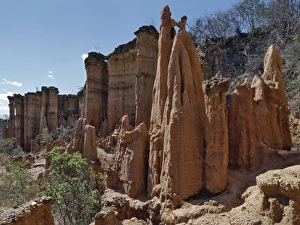
Beautiful earth and stone pillars fashioned by centuries of weathering, make the important stone-age site of Isimila an attractive place to visit In the late 1950 s
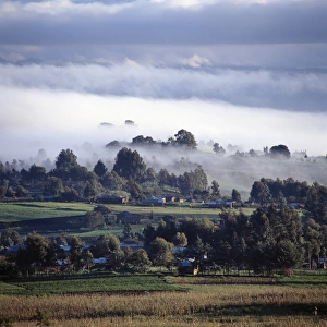
Early morning mist in Tanzanias Southern HighlandsA small market centre near Mbeya is bathed in sunlight as an early morning mist clears from this fertile farming region of Tanzanias Southern Highlands
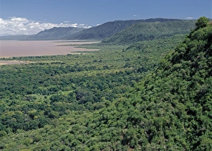
Western wall of the Great Rift Valley above Lake ManyaraA section of the western wall of the Gregory Rift (a part of the eastern branch of the Africas Great Rift Valley) above Lake Manyara, a shallow alkaline lake
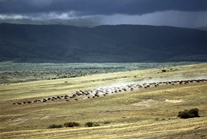
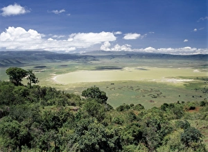
The world famous Ngorongoro Crater. Its 102-square-mile crater floor is the haunt of a wonderful wildlife spectacle
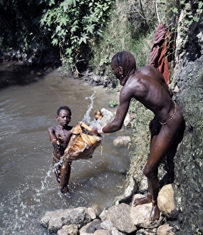
Msai warriors draw water for livestock from a wellMsai draw water for livestock from a well
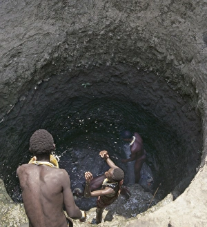
Deep Msai wells at Loibor Serrit where cattle paths are cut deep into the soil to allow livestock nearer to the source of water
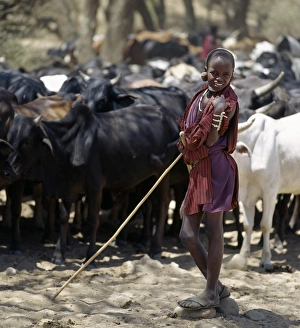
A young Msai herdsboy controls his familys cattle at the Sanjan River to prevent too many animals watering at the same time
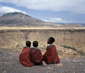
Three Msai girls at Shimu la MunguThree Msai girls sit on the edge of Shimu la Mungu (a volcanic blow hole known as Gods hole ) with the extinct volcano, Kerimasi, in the distance
Lake Natron in the Rift ValleyLake Natron in northern Tanzania is one of the most alkaline of the Rift system. As its waters evaporate in the intense heat, sodium sesquicarbonate, known as trona or natron
Lake Eyasis impressive western escarpmentLichen-stained boulders and Euphorbia trees add form and colour to Lake Eyasis impressive western escarpment