mail_outline sales@mediastorehouse.com
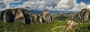
Panoramic view over the spectacular massive rocky pinnacles of Meteora, Thessaly, Greece
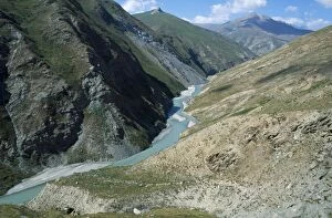
Yagnob ValleyThe Yagnob River runs through the Yagnob Valley high in the Fann Mountain Range
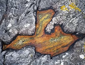
Lichen in a rock pool at Amhuinnsuidhe
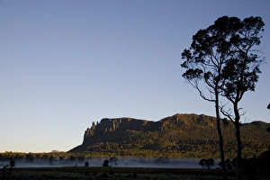
Mount Oakleigh seen from New Pelion Hut on the Overland Track
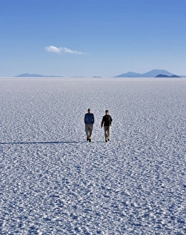
Two tourists walk across the endless salt crust of the Salar de Uyuni, the largest salt flat in the world at over 12, 000 square kilometres
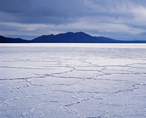
During the dry season, a web of polygonal lines of salt form on the salt crust of the Salar de Uyuni, the largest salt flat in the world at over 12, 000 square kilometres
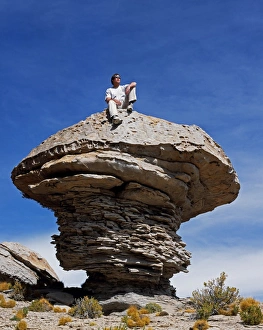
A tourist sits on top of a massive wind-eroded boulder that rises above the altiplano close to Laguna Turquiri
Flamingos feed on the algae-rich waters of Laguna Colorada. The distinctive red colour of this high altitude lagoon is due to the high concentration of algae whilst deposits of borax form a white
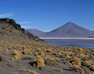
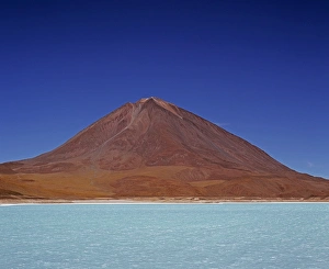
The striking turquoise waters of Laguna Verde with the perfect cone of Volcan Licancabur 5868 m rising above it. The distinctive green colour of the water is due to the high concentration of arsenic
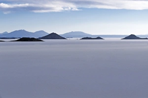
View across the great white expanse that is the Salar de Uyuni, the largest salt flat in the world, towards the distant Andean peaks
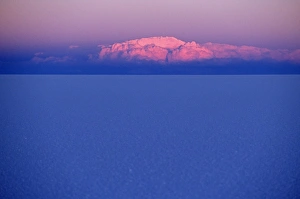
At sunset a cloud is painted pink by the last rays of the sun over the Salar de Uyuni, the largest salt flat in the world
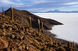
View from the top of Isla de Pescado (Fish Island) across the Salar de Uyuni, the largest salt flat in the world
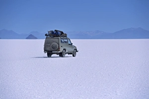
A vehicle drives across the crusted salt of the Salar de Uyuni, the largest salt flat in the world
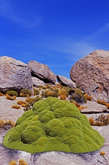
Yareta, an extremely tough, green pillow-like plant that grows at altitude on the altiplano is collected by the local people and burnt for cooking and heating fuel
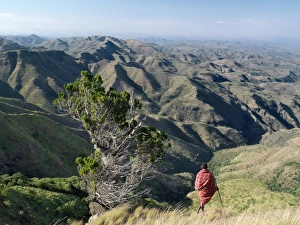
A Samburu warrior looks out over a vast expanse of inhospitable country from the eastern scarp of Africas Great Rift Valley at Losiolo, north of Maralal
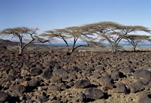
Lava boulders cover vast tracts of infertile land on the eastern side of Lake Turkana. Often referred to as the Jade Sea due to its distinctive colour, Lake Turkana is a true desert lake
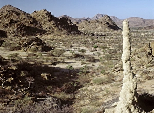
Inhospitable, semi-arid, thorn scrub country northwest of Lodwar, the administrative centre of the Turkana people. All the hills and mountains are of volcanic origin
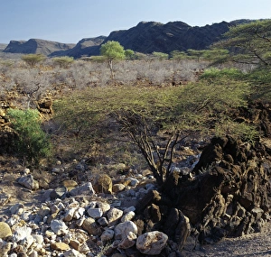
Semi-arid, thorn scrub country, littered with lava debris, near Parkati. Being extremely hot and dry, the area is only used by the nomadic Turkana for grazing goats and camels
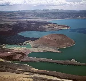
An aerial view of the southern end of Lake Turkana, which is named Von H_hnel Bay after the Austrian naval officer who was part of an epic journey of exploration to reach the lake in 1888
On the inhospitable lava-strewn hills surrounding the inlet of Ghoubbet el Khar‰ b (the Devils Throat), a relative of the Dragons Blood Tree (Dracaena orbet)
The volcanic island of Ounda Ginni KmaThe volcanic island of Ounda Ginni K ma (the small Hill of Devils) situated near Ghoubbet el Kharab (the Devils Throat), a region of high seismic activity where deep fractures in the lava continue to
After a rain shower, shrubs of the Pea family (Papilionoideae) give a splash of colour to the forbidding landscape near Ghoubbet el Kharab (the Devils Throat)
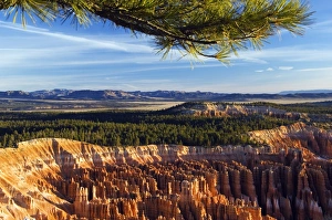
USA, Utah, Bryce Canyon National Park. Haunting and colourful rock pinnacles known as Hoodoos at Inspiration Point
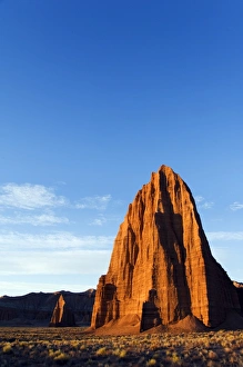
USA, Utah, Capitol Reef National Park. Cathedral Valley sunrise at the Temple of the Sun and smaller Temple of the Moon
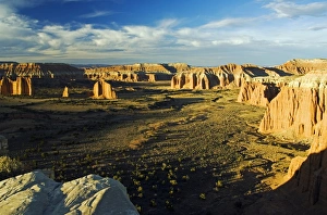
USA Utah Capitol Reef National Park Cathedral Valley
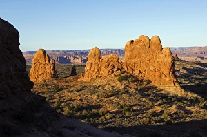
USA, Utah, Arches National Park, pinnacles and spires of the Windows Section
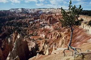
A lone tree stands isolated by erosion on the rim of Bryce Canyon with the bizarre eroded rock formations known as Hoodoos in the background A lone tree stands isolated by erosion on the rim of Bryce
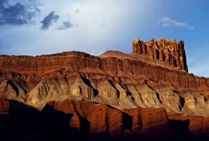
Tall cliffs, layered in different coloured clays and stone, typify the landscape of Capitol Reef
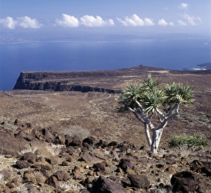
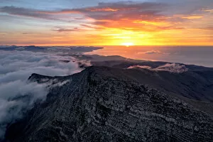
Pico de la Zarza peak emerging from clouds, Jandia, Fuerteventura, Canary Islands, Spain
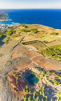
Aerial view of emerald lake and bauxite quarry with crystal clear sea on background, Otranto, Lecce province, Apulia, Italy
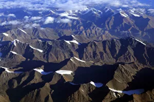
Xinjiang Uyghur Autonomous Region, China
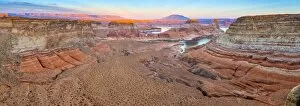
USA, Utah, Glen Canyon National Recreation Area, Lake Powell, Gunsight Bay at dusk from Romana Mesa