mail_outline sales@mediastorehouse.com
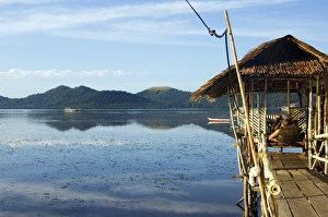
Philippines, Palawan Province, Busuanga Island, Coron Town. Waterfront stilt houses
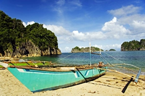
Philippines, Luzon Island, Bicol, Camarines Sur. Caramoan National Park. A fishing catamaran on Gota Beach
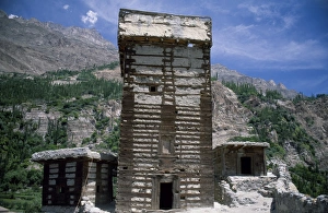
The medieval fort at Altit. Around 2, 800 metres above sea level
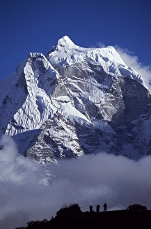
Climbers on ridge in the Dodh Koshir River Valley photograph a glacier clad Himalayan peak of the Everest Range
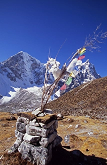
Cairn and prayer flags in the Dzonglha area
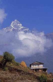
Hillside house with the fishtail peak of Machhapuchhare 6, 993 metres behind
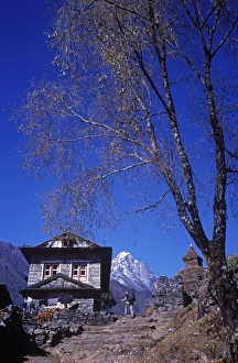
Traditional stone house, Chaurikharka near Lukla on the Everest Trek
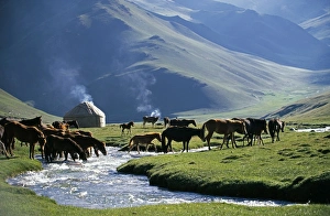
Kyrgyzstan, Tash Rabat Valley. Shepherds summer camp. The Caravanserai of Tash-Rabat was constructed in the 15th century, on the ancient trade route from Central Asia to China
Indonesia, Sulawesi, Banggai Islands. Small resort on Sago Atoll
Remains of a Buddhist stupa, circa 3rd century Ad. Height: 6 metres. Niya, north of Minfeng. This single ruined stupa of modest size stands at the centre of the site
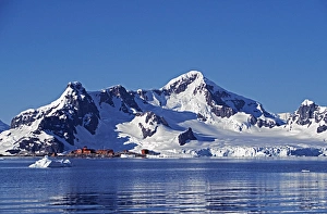
Antarctica, Antarctic Peninsula, Paradise Harbour. The Chilean base in Paradise Harbour on the Antarctic Peninsula
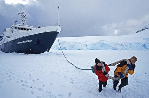
Antarctica, Wiencke Island, Port Lockroy. Towing the ship Expedition ship Clipper Adventurer garaged in sea-ice
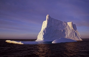
Antarctica, Bransfield Strait. Iceberg at sunset
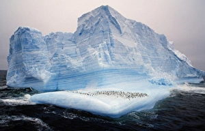
Antarctica, Scotia Sea. Chinstrap penguins (pygoscelis antarctica) on iceberg
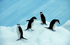
Antarctica, South Orkney Islands, Laurie Island. Chinstrap (pygoscelis antarctica) & Adelie (pygosclis adeliae). Antarctica, South Orkney Islands, Laurie Island
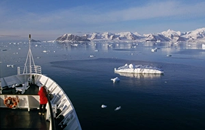
Antarctica, Adelaide Island, The Gullet. Cruise ship entering Marguerite Bay
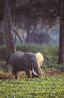
Elephant in early morning mist feeding on water hyacinths
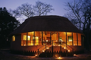
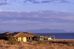
Zambia; Kasanka national park, Wasa lodge. New Bar, dining & lounge hut at Wasa Lodge, lit up in the evening. Zambia; Kasanka national park, Wasa lodge
Lake Mutanda is possibly the most beautiful lake of the Great Lakes region. It has an idyllic backdrop of five volcanoes of the Virunga chain, which straddle the Uganda-Rwanda border
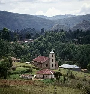
The Catholic church at Nyaruhanga is of an unmistakable Italian style. It was built by Italian missionaries during the last century
Situated in the fertile foothills of Mount Elgon, Sipi Falls is small but beautiful. Mount Elgon is an extinct volcano straddling the border between Uganda and Kenya; it rises to a height of 14
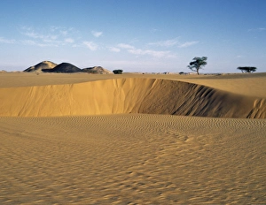
Attractive desert scenery in the Bayuda Desert of northeast Sudan, which is an extension of the great Sahara Desert
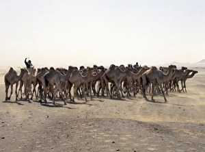
A camel trader drives his camels through a sandstorm on the southeast edge of the Northern or Libyan Desert, which forms a part of the Sahara Desert.& #x26; #x26; #x26; #x0B; Traders are
A camel rider drives his camels through a sandstorm on the southeast edge of the Northern or Libyan Desert, which forms a part of the Sahara Desert
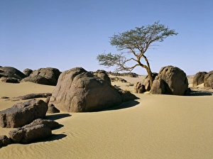
A lone Acacia tree struggles to survive among rocks and boulders in the Nubian Desert. The Nubian Desert in Northeast Sudan is an extension of the Sahara Desert
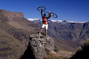
Mountain biker, Drakensburg
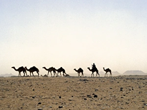
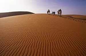
Niger, Tenere Desert. Camel Caravan travelling through the Air Mountains & Tenere Desert. This is the largest protected area in Africa, covering over 7.7 million hectares
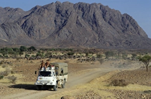
Scenery on the fringe of the Air Mountains
Beautiful red sandstone cliffs surround the isolated Waterberg Plateau, a 50 km long table mountain, which has become a park for rare and threatened species
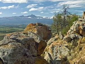
Kenya, Nanyuki District. Majestic Mount Kenya in the early morning from the Loldaiga Hills
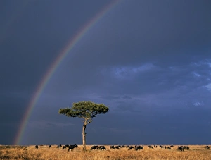
A rainbow in Masai Mara with white-bearded gnus, or wildebeest, grazing the dry grassy plains
The research centre of Koobi Fora looks out over Lake Turkana. Many important paleontological discoveries have been made in the area, including fossilised hominid remains of Homo erectus
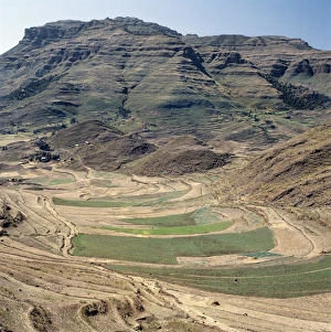
A small dirt road winds its way through fine farming country at the top of the 11, 000-feet-high Cherangani Hills. There, small-scale Pokot farmers grow maize, potatoes and pyrethrum
A waterfall with brackish water flows from a swamp in Shaba National Reserve, a beautiful area adjacent to the Samburu National Reserve in Northern Kenya
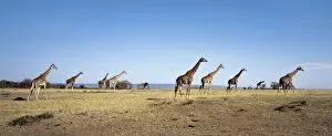
A herd of Masai Giraffe (Giraffa camelopadalis tippelskirchi) stride across the dry, grassy plains of Masai Mara Game Reserve
Traditional thatched homesteads perched on top of the fertile Tugen Hills, looking across the Kerio Valley to the western scarp of the Gregory Rift (the Keiyo Escarpment)
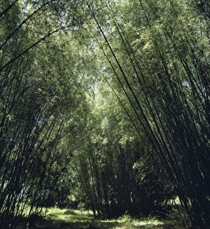
Kenya, Aberdare National Park, Aberdare Mountains. Mountain bamboo (Arundinaria alpina) grows on Mount Kenya and the Aberdare Mountains at an altitude of between 7, 000 feet and 9, 000 feet
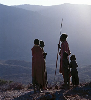
As the sun rises above the forested peaks of Mount Nyiru, members of a Turkana family chat and plan their days activities
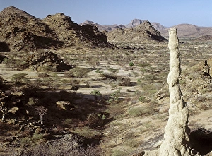
Inhospitable, semi-arid, thorn scrub country northwest of Lodwar, the administrative centre of the Turkana people. All the hills and mountains are of volcanic origin
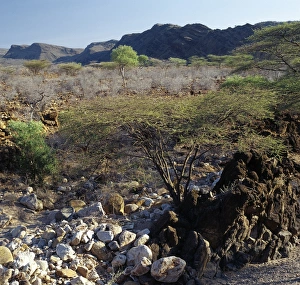
Semi-arid, thorn scrub country, littered with lava debris, near Parkati. Being extremely hot and dry, the area is only used by the nomadic Turkana for grazing goats and camels
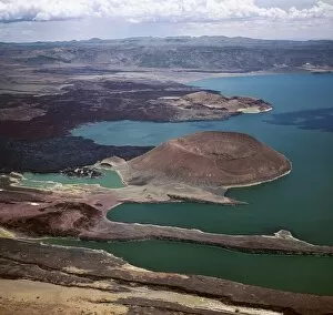
An aerial view of the southern end of Lake Turkana, which is named Von H_hnel Bay after the Austrian naval officer who was part of an epic journey of exploration to reach the lake in 1888
Ethiopia is a land of vast horizons and dramatic scenery. The weathered mountains in the Ethiopian Highlands exhibit layer upon layer of volcanic material
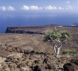
On the inhospitable lava-strewn hills surrounding the inlet of Ghoubbet el Khar‰ b (the Devils Throat), a relative of the Dragons Blood Tree (Dracaena orbet)
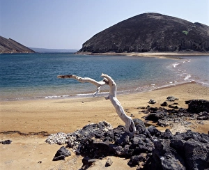
The volcanic island of Ounda Ginni KmaThe volcanic island of Ounda Ginni K ma (the small Hill of Devils) situated near Ghoubbet el Kharab (the Devils Throat), a region of high seismic activity where deep fractures in the lava continue to
After a rain shower, shrubs of the Pea family (Papilionoideae) give a splash of colour to the forbidding landscape near Ghoubbet el Kharab (the Devils Throat)
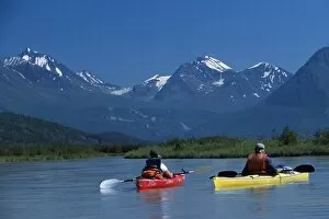
Kayaking, Moose Valley
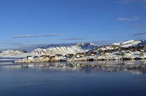
Greenland, Ittoqqortoormiit. The isolated village of Ittoqqortoormiit (Scoresbysund) situated on the north east coast of Greenland. It has 2 food deliveries a year by boat
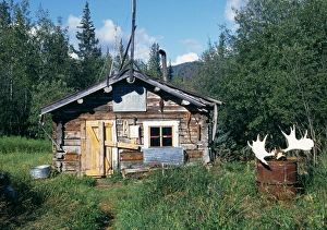
A log cabin inhabited during the winter