mail_outline sales@mediastorehouse.com
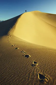
Mesquite Dunes, Stovepipe Wells, Death Valley National Park, California, USA
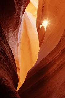
Lower Antelope Slot Canyon, Page, Arizona, USA
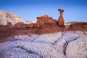
The Toadstools, Paria Rimrocks, Utah, USA
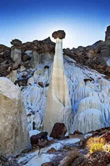
Valley of the White Ghosts, Grand Staircase-Escalante National Monument, Utah, USA
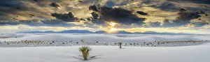
Yucca Plants, White Sands National Monument, Alamogordo, New Mexico, USA
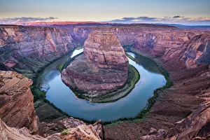
Horseshoe Bend, Page, Arizona, USA
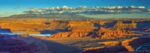
USA, Utah, Moab, Dead Horse Point State Park
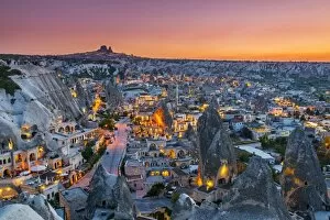
Sunset view over Goreme, Cappadocia, Turkey
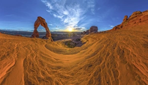
USA, Utah, Moab, Arches National Park, Delicate Arch
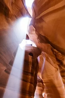
Upper Antelope Canyon, Page, Arizona, USA
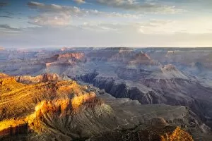
Sunrise over Yavapai Point, South Rim, Grand Canyon National Park, Arizona, USA
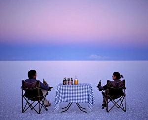
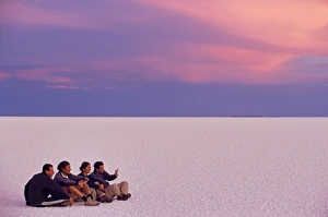
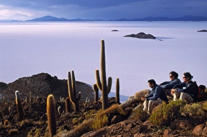
Tourists enjoy sundowners while looking out across the endless salt crust of the Salar de Uyuni, the largest salt flat in the world at over 12, 000 square kilometres
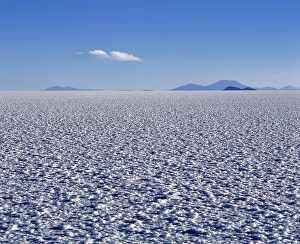
The endless salt crust of the Salar de Uyuni, the largest salt flat in the world at over 12, 000 square kilometres
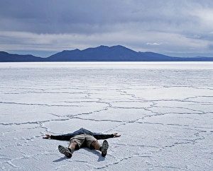
A tourist lies on the salt crust of the Salar de Uyuni, emphasising the scale of the largest salt flat in the world at over 12, 000 square kilometres
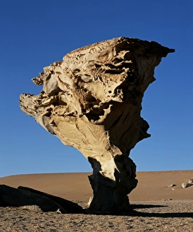
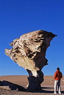
Arbol de Piedra or Stone Tree is a massive wind-eroded boulder, 8 metres high that rises above the altiplano
A group of tourists sit on the great expanse of salt that is the Salar de Uyuni, the largest salt flat in the world. At sunset the salt glows yellow and then pink
Tourists enjoy the view from the top of Isla de Pescado (Fish Island) across the Salar de Uyuni, the largest salt flat in the world
A tourist looks at the Arbol de Piedra or Stone Tree, one of the rock outcrops of the so-called Rock Forest that rise above the altiplano
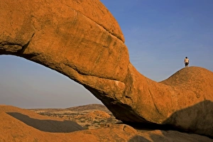
Namibia, Namib Desert, Spitzkoppe Mountain. One of the features of this community managed park is the impressive Rock Arch here at sunset with an intrepid tourist climbing along its ridge
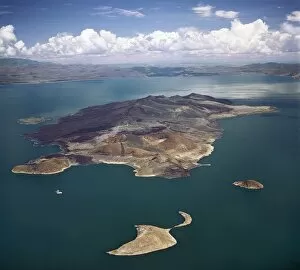
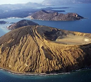
An aerial view of South Island, Lake Turkanas largest island. Situated in the southern sector of the lake where the water reaches a depth of 374 feet
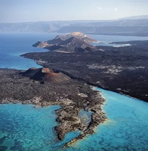
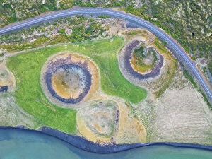
An aerial view of the caldera Sisale KmaAn aerial view of the caldera Sisale K ma, which is 3, 937 feet in diameter and 300, 000 years old. It is situated at the inlet of Ghoubbet el Kharab (the Devils Throat)
An aerial view of the volcanic cones at the inlet of Ghoubbet el Khar‰ b (the Devils Throat), a region of high seismic activity where deep fractures in the lava continue to widen year by year
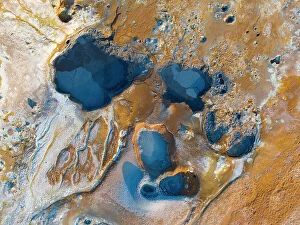
Aerial view of the beautiful geothermal area near to Myvatn Lake during a summer day, Iceland
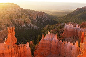
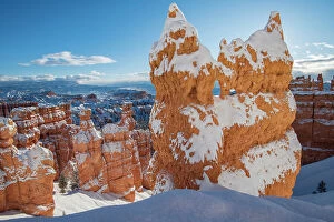
Bryce Canyon National Park during a summer sunrise, Utah , USA
Mesa desert area near to Hanksville , Utah , USA
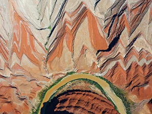
Aerial view of river and Rock formation, Utah , USA
Old volcano and ashpalt road, near to Myvatn lake during a summer day, Iceland
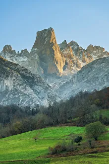
Sunset view over Naranjo de Bulnes (Picu Urriellu), Picos de Europa, Asturias, Spain
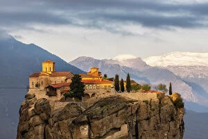
The Holy Trinity Monastery (Agia Triada), Meteora, Greece
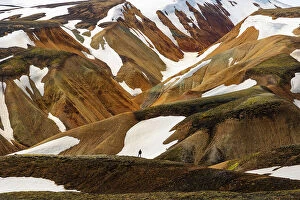
Landmannaugar area during a summer day, Iceland
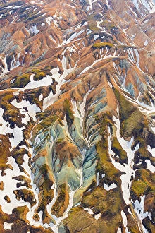
aerial view of Landmannaugar area during a summer day, Iceland
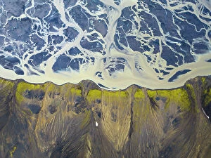
Aerial view of icelandic river during a summer day, Southern Iceland
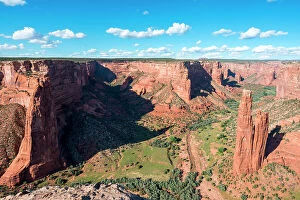
Spider Rock, Canyon de Chelly National Monument, Chinle, Arizona, USA
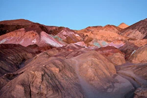
Blue Hour at Artists Palette, Death Valley National Park, California, USA
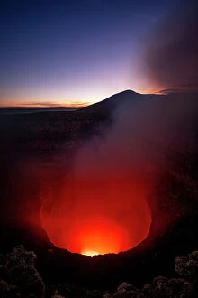
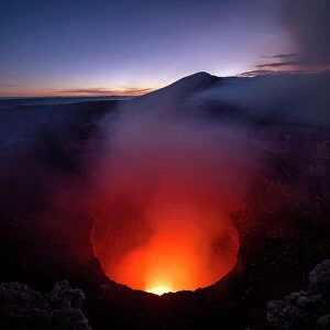
Volcan Masaya, Parque Nacional Volcan Masaya, Meseta Central, Nicaragua
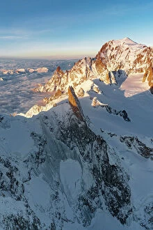
Aerial view of Dent du Geant rock pinnacle in Mont Blanc Massif covered with snow at dawn, Chamonix, Haute Savoie, France
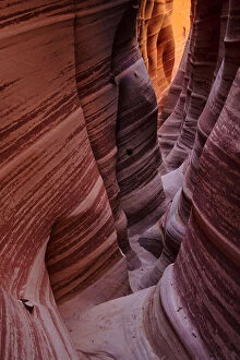
USA, Southwest, Colorado Plateau, Utah, Garfield County, Grand Staircase - Escalante National Monument, Hole in the rock road, Zebra slot canyon
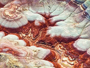
USA, Southwest, New Mexico, San Juan County, Bisti, De-Na-Zin Wilderness
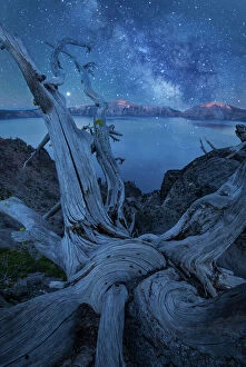
USA, Oregon, Crater Lake National Park, Milky Way and tree snag (m)
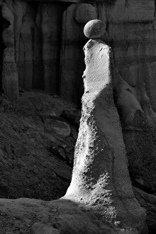
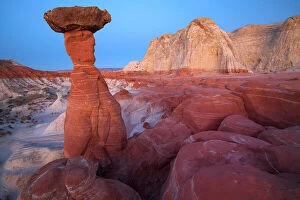
USA, Southwest, Colorado Plateau, Utah, Toadstool Hoodoos, Grand Staircase-Escalante National Monument
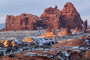
USA, Southwest, Utah, Moab, winter landscape at Arches National Park
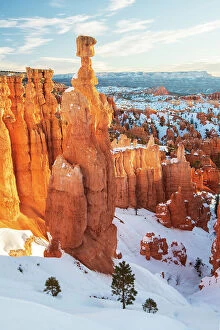
USA, Southwest, Colorado Plateau, Utah, Bryce Canyon, National Park
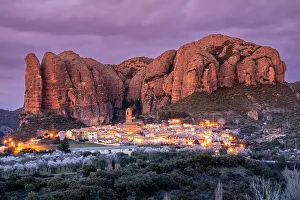
Scenic view of the village with the Mallos de Aguero rock formations behind, Aguero, Huesca, Aragon, Spain
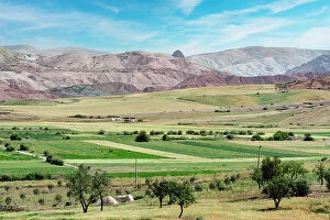
Agricultural fields in the green valley with Rif mountain range on background, Morocco, North Africa
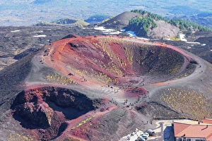
Crateri Silvestri, high angle view, Etna, Sicily, Italy
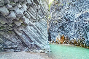
Alcantara gorge, Castiglione di Sicilia, Sicily, Italy